Aitana Oltra, John R.B. Palmer & Frederic Bartumeus
ICREA-Movement Ecology Laboratory (CEAB-CSIC) / Centre for Ecological Research and Forestry Applications (CREAF)
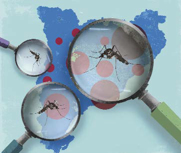
AtrapaelTigre.com is a ground-breaking project based on the use of new technologies to compile data for studying, monitoring and controlling the tiger mosquito, with the help of the public.
The tiger mosquito (Aedes albopictus) is an invasive species originating in South East Asia. In just a few years, it has earned itself a terrible reputation everywhere it goes. As well as being a highly annoying species, because of its daytime habits and aggressiveness, it also represents a public health hazard as it can carry tropical viral diseases such as Dengue, chikungunya and the West Nile virus. The tiger mosquito was first detected in 2004 in Sant Cugat del Vallès, a town in the Greater Barcelona Area. It is now widespread along the entire east coast of the Iberian peninsula and on the Balearic Islands, although the actual extent of its presence in Spain and Portugal is unknown.
The tiger mosquito is mostly found in urban areas and it has therefore become a problem that affects a large proportion of the population. And it is our own habits that bear much of the responsibility for the mosquito spreading and establishing itself so successfully. Not only does it travel with us in our cars, it also breeds in small receptacles on balconies and in gardens, fountains, sewers, etc., anywhere that has contained stagnant water for just a few days.
AtrapaelTigre.com
AtrapaelTigre.com is a ground-breaking project based on the use of new technologies to compile data with which to study, monitor and control the tiger mosquito. Traditionally, this task has been the responsibility of the health authorities and scientists, but the public is now becoming involved too. The idea is not just to obtain scientific and environmental data, but also to learn more about the biology and ecology of the tiger mosquito and all the issues involved. The project also aims to educate the public on good behaviours that will reduce the population of this insect in urban areas, thereby decreasing the potential risk of transmission of viral diseases.
AtrapaelTigre.com is an initiative developed by the ICREA-Movement Ecology Laboratory of the Centre for Advanced Studies of Blanes (CEAB-CSIC), with funding from the Spanish Foundation for Science and Technology (FECYT-MINECO). It is backed by several public and private institutions, as well as the CSIC and the University of Murcia, with additional funding from the RecerCaixa programme and the insecticides company Bloom.
The project is built around three pillars: training and public awareness-raising through face-to-face workshops, educational materials, publicity and online communication through the project website (www.atrapaeltigre.com) and social media, and public involvement through the Tigatrapp app. It began in 2013 as a small-scale pilot project, capitalising on the more than 200 workshops held annually by the Badia de Roses and Baix Ter Mosquito Control Service in schools across the province of Girona. The app and the web map were originally designed for children and their families. Currently, participation is free and open to all members of the public, although participants are asked to get some prior training through the project website or at one of the many face-to-face events that are organised, to ensure the quality of the data that is sent.
With Tigatrapp, members of the public can send, compile and share data on sightings of the tiger mosquito and potential breeding grounds in public spaces (sewers, neglected fountains, etc.). Each piece of data is linked to a report with a description of the finding: a three-question survey to confirm the species and another three questions to categorise the breeding ground. The geolocation of the finding is also collated, as well as any photos and/or additional notes. The data are automatically published on the project web map. There is a possibility that not all sightings are actually of the tiger mosquito, so the data has to be validated by experts. With this in mind, photos and all additional information are very useful. The web map shows which areas have participants; five low-resolution positions a day are enough to know the sampling distribution and this in turn means that specific tasks can be delegated to participants located in areas of special interest (geolocalised missions).
The challenge facing a project such as AtrapaelTigre.com is that its success not only depends on the team, but also on a whole range of other factors, such as the public’s sense of responsibility, the communication dynamics, sociological issues and the ability to overcome technological barriers. Despite this, we believe that the experience with the tiger mosquito is an excellent case study of how to put scientific concepts into practice in wider society. We hope that in the not too distant future we will have other public alert systems for diseases or invasive species and that these systems can be used as new tools for public health management.
Open access data and privacy protection
Public science should, on principle, involve members of the public as participants with full rights. This means that we are open to receiving criticism and opinions from the public to help us improve our research and the quality of our projects. Furthermore, we make our data and tools available to the public. As well as consulting the maps and statistical reports on our website, participants themselves can also download the data to analyse. All the applications and server elements are licensed as free and open code software (GPLv3). The source code is available on the net for anyone to improve or expand.
In public science projects, there is often some (technological) tension between the open data philosophy and individuals’ privacy. In previous projects, we solved this problem by using sophisticated coding techniques to protect users, which meant that the users themselves had fewer opportunities to access and use data.
For this project we have taken a different approach: all the data (having gone through a very basic filter) are open-access and we simply avoid collecting any private information. When registering, we ask users to read our policy and/or declaration of principles and to give their informed consent before starting to take part. We don’t ask for any names, passwords or any other personal information. The actual location of the user (a piece of data that helps us know the extent of the sampling work and to send geolocalised missions) is never sent from our app to our server. Instead, the app first enters the actual location into a pre-set grid and transmits only the grid identification (an area approximately the size of a town such as Blanes). In other words, we have no way of knowing the exact position of the participant within this area, or who the participant is. This is one example of best practice that public science projects should comply with wherever possible.


Tinc una proposta de actuació sense cost, que pot ajudar a reduir la població de mosquits.
He consultat amb un parell d’experts i diuen que és factible
Voldria contactar amb algun responsable amb capacitat per implementar-la
Gràcies
P e p /