


GeoportalBCN
Applications
Main components of the Spatial Data Infrastructure
-
 City Council SDI Viewer
Access to the viewer and the metadata catalogue of the Spatial Data Infrastructure of the City Council.
-
 Download portal
Access to the platform for downloading municipal cartographic products on different subjects and in different formats and layouts.
-
 Service catalogue
Interoperable cartographic services offered by the City Council to reference the municipal cartography from platforms and applications.
-
 BCN PIC
Access to the Cartographic Information Point (BCNPIC) to find the urban, topographic or land plot map for an address.
-
 PIU
PIUAccess to the Urban Information Portal (PIU), which includes up-to-date urban planning information on the city of Barcelona: documents on urban planning, urban management and license suspensions, and the list of architectural heritage elements.
-
 Barcelona Map
View the Barcelona Map, with all the information on services, facilities and transport in the city.
-
 Developers’ area
Development environment for quickly and simply integrating municipal maps and the geolocation of addresses into the website.
-
 Barcelona 3D
Three-dimensional model of the built-up volumes of the municipal topographic cartography.
Highlights
Featured websites


Themed viewers of Barcelona
Other City Council urban information tools
-
 Street names
History of street names in Barcelona.
-
 Public works information service
Information and visualisation of map of public works in the city.
-
 Municipal Topographic Network
Website of the Municipal Topographical Network
-
 Environmental data maps
Access to the tools that provide detailed information on environmental quality in the city.
-
 Coastal plan
Access to the 3D map of projects in coastal areas of the city.
-
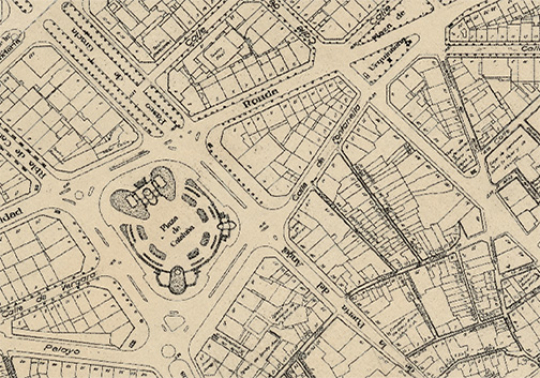
 The Garriga i Roca quarterons maps
Go to the “Barcelona, darrera mirada” [Barcelona, a last look] website to view Miquel Garriga i Roca’s famous 19th-century map of Barcelona.
-
 Viewer for the Comprehensive Maintenance Plan (PMI)
Map allowing users to check work on the maintenance and renovation of public space planned within the framework of the Comprehensive Maintenance Plan in Barcelona.
-
 Martorell viewer
View the maps of Barcelona from 1927-1933 generated by the Oficina del Pla de la Ciutat and georeferenced by the Arxiu Municipal Contemporani to a scale of 1:500 and 1:2000.